
Jalur Baru Pendakian Gunung Sumbing Dilengkapi Gelang RFID untuk Keamanan Pendaki
Suara Pecari | The regional tourism board announced the opening of a new trail to Gunung Sumbing, equipped with RFID wristbands for all hikers. The initiative aims to improve safety and visitor management.
The trail, located on the northern slope, shortens the ascent time by roughly 30 minutes compared to the traditional route. It also offers panoramic views of the surrounding valleys.
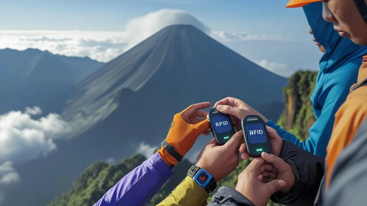
RFID wristbands are distributed at the trailhead registration point after hikers complete a brief briefing. Each band contains a unique identifier linked to the visitor’s data.
Sensors installed along the path record the presence of each wristband in real time. This data feeds into a central monitoring hub operated by the park authority.
In case of an emergency, rescue teams can locate a missing hiker within minutes using the RFID signal. The system reduces response time significantly.
The technology also helps prevent unauthorized access to restricted zones. Gates equipped with RFID readers automatically block entry for unregistered bands.
Local authorities collaborated with a tech startup specializing in low‑power RFID solutions. The partnership enabled the deployment of durable, weather‑resistant devices.
Environmental groups praised the project for minimizing the need for physical patrols. Reduced human traffic in sensitive areas helps protect fragile flora.
The wristbands are reusable and can be returned at the exit point for cleaning and sterilization. A small deposit fee encourages responsible handling.
Hikers are required to wear the band visibly on the wrist throughout the trek. Removal of the band without permission may result in a fine.
The trail’s signage now includes QR codes that link to safety guidelines and real‑time weather updates. Information is provided in both Indonesian and English.
Early feedback from the first batch of trekkers indicates high satisfaction with the added sense of security. Many expressed willingness to recommend the route to fellow adventurers.
The tourism board plans to expand RFID coverage to other popular peaks in East Java. Future phases may incorporate biometric verification at entry points.
Funding for the project came from a combination of regional budgets and private sponsorships. The total cost was estimated at three billion rupiah.
Critics argue that data privacy concerns must be addressed before wider rollout. Officials responded that all personal data is encrypted and stored for only 48 hours.
The monitoring center operates 24/7, staffed by trained operators who can trigger alerts to nearby rescue units. Communication channels include radio and satellite links.
Seasonal variations, such as heavy rain, have been factored into the system’s design. Sensors are sealed to resist moisture and temperature fluctuations.
The new route also includes designated rest areas equipped with solar‑powered charging stations for electronic devices. Hikers can recharge phones without leaving waste.
Local businesses anticipate increased visitor flow, boosting income for homestays and food vendors near the trailhead. The initiative aligns with regional economic development plans.
Conservation experts monitor trail usage statistics to adjust visitor caps during peak periods. Balanced access aims to preserve the mountain’s natural integrity.
The RFID system represents a broader shift toward smart tourism in Indonesia. Authorities see technology as a tool to enhance experiences while safeguarding resources.
As the first month concludes, authorities report zero major incidents and a steady stream of satisfied trekkers. The success sets a benchmark for future adventure infrastructure projects.


Tinggalkan Balasan
Anda harus masuk untuk berkomentar.